B2B GEOSPATIAL DATA · DATA.EVGENYBELAVSKY.COM

Data,engineered intogeospatialproducts

GAR/FIAS address change datasets, verified fuel stations and custom geospatial datasets for logistics, mapping, retail, fintech and spatial analysis.

One-off deliveryor recurring updates
Flexible coveragefrom a region to a custom AOI
Enterprise-ready formatsGeoPackage, PostGIS, CSV, JSON
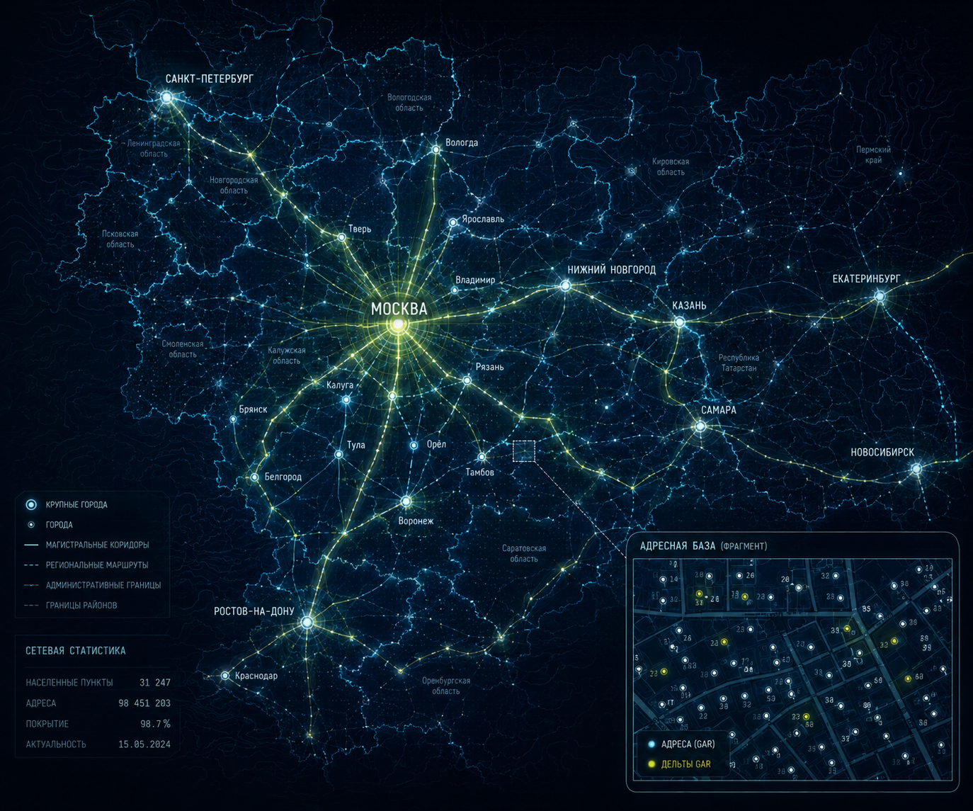
Digital map of central Russia showing Moscow, administrative boundaries, cities, transport links and a sample GAR/FIAS address change dataset
LogisticsMappingMarketplacesRetailFintechSpatial Analysis
CATALOG

Production-ready geospatial data products

Each dataset can be tailored to a required area of interest, attribute schema, update frequency and target information system.

01
Address DataGAR / FIASData Architecture

Address database design and implementation based on GAR/FIAS

Design and implementation of a complete address database and a recurring update pipeline aligned with the data model and integration requirements of an organization's information systems.

GAR/FIAS is the official state address registry of the Russian Federation, used as the authoritative address source by public authorities and government information systems.

  • Address data model design for business and system requirements
  • GAR/FIAS data processing and normalization
  • Geospatial referencing of address objects
  • Administrative and municipal hierarchy assignment
  • Quality control, deduplication and change processing
  • Complete database delivery and recurring update pipeline
  • Delivery format and schema aligned with the target information system
02
GAR / FIASChange DataRussia

GAR/FIAS change dataset (delta)

GAR/FIAS change datasets are structured changes from the official Russian address registry, including added, modified and retired address objects. The current public sample and statistics focus on newly added addresses.

  • Full normalized address and GAR/FIAS identifiers
  • Spatial location of each address object
  • Administrative and municipal hierarchy
  • Delivery formats: GeoPackage, PostgreSQL / PostGIS, GeoJSON / JSON, SHP, CSV / XLSX
  • Optional delivery mapped to OpenStreetMap address keys
  • National, regional, municipal and custom AOI extracts
2026 CHANGE ACTIVITY

New address objects by month

Observed number of newly added GAR/FIAS address objects identified through monthly data processing.

—new objects since the beginning of 2026
03
Web GISGAR / FIASGeoPackage

Address Data Service

A production web service for generating a spatial address database for a selected area in Russia. It combines cadastral geometry with GAR/FIAS records and delivers a ready-to-use GeoPackage while preserving FIAS identifiers.

  • Select an area directly on the web map
  • Point addresses for buildings and land parcels
  • Parcel polygons for land-address records
  • GAR/FIAS structure and identifiers preserved in the result
04
TajikistanADM1–ADM4Streets

Tajikistan National Address Registry

A reconstructed nationwide hierarchy from the official address register: ADM1–ADM4 plus all street names registered in the state registry. The dataset is prepared for recurring monthly updates and change detection.

  • Complete nationwide administrative hierarchy
  • All registered street names from the state registry
  • Structured multilingual attributes where available
  • Prepared for recurring monthly updates and change detection
05
Fuel StationsTransport InfrastructureLocation Intelligence

Verified fuel stations

Geospatial dataset of active fuel stations whose location and operating activity are validated using multiple signals, including aggregated indicators of fuel-related payment activity, with brand, commercial name and fuel types.

  • Location, address, brand and commercial name
  • Fuel types and facility category
  • Period of verified activity
  • Administrative and municipal hierarchy
APPROACH

From raw source data to production-ready geospatial products

The core value is created through data cleaning, normalization, spatial processing and adaptation to the customer's business and system requirements.

01

Data acquisition and integration

Integration of government, commercial and open data sources into a consistent data model.

02

Cleaning and normalization

Deduplication, attribute harmonization, identifier validation and data quality control.

03

Spatial processing and enrichment

Coordinate assignment, administrative attribution, spatial joins with boundaries and road networks, and derived geospatial attributes.

04

System-specific delivery

Definition of the required schema, fields, delivery format and recurring update logic for the target system.

FORMATS & INTEGRATION

Delivered in formats ready for business systems

GeoPackageFor desktop GIS workflows and exchange of large spatial datasets
PostgreSQL / PostGISFor enterprise databases, geospatial platforms and analytics
GeoJSON / JSONFor web services, APIs and lightweight integrations
CSV / XLSXFor analysis, audit and business workflows
Custom schemaFields, keys and structure aligned with the target system
Recurring deliveryScheduled, periodic or change-driven updates
USE CASES

Where these datasets create value

01

Last-mile logistics

Address maintenance, delivery zones, service points and routing workflows.

02

Navigation and mapping

POI maintenance, geocoding, address search and infrastructure layers.

03

Retail and network expansion

Coverage analysis, competitive landscape assessment and evaluation of new locations.

04

Spatial analytics

Location intelligence, area scoring and enrichment of enterprise data with geospatial context.

DATA REQUEST

Request a sample dataset

Describe the product, area of interest and intended use case. After the requirements are clarified, I will propose an appropriate delivery schema and format.

Full datasets are not published openly. A limited sample is provided for data quality and schema evaluation.